
tags:
wind river range snow |western u.s. snowfall |utah snow forecast |unexpected snow |tetons snow forecast |telluride snowfall |spring snow event |spring skiing |snowstorm forecast |snowboarder's dream |snowboard |snowbird snow totals |snow accumulation |skier's delight |ski season extension |ski |premium content |powder alert |news |mountain weather |may snowstorm |late-season snowfall |fresh powder |featured |colorado snow forecast
May Powder Surprise: Up to 20 Inches Forecasted for the West
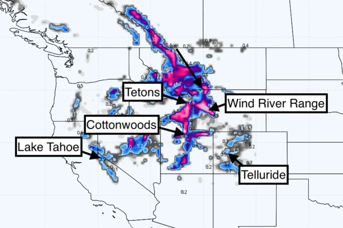
Snow totals through Tuesday, May 20, 2025. Photo: WeatherBell/Powderchasers
Just when it seemed like spring had firmly taken hold, Mother Nature has a surprise in store for the Rockies. A significant snowstorm is poised to blanket parts of Colorado and Utah, with forecasts predicting impressive accumulations that are more reminiscent of mid-winter than late May.
According to recent reports, the storm is expected to deliver:
Wind River Range: 12–18 inches
Snowbird, Utah: 9–14 inches
Telluride, Colorado: 5–10 inches
Tetons: 3–5 inches
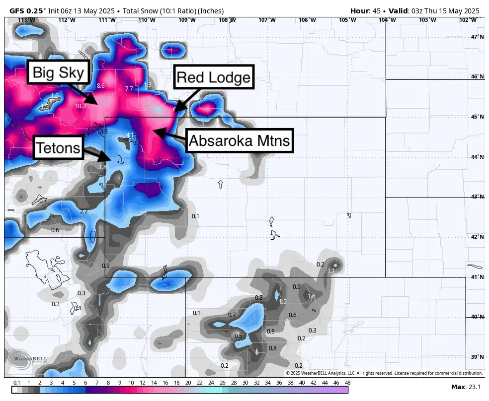
Total snowfall through late Wednesday, May 14th will be abundant near the Wyoming and Montana border. The Wasatch is a bit more bullish on other models not shown here and is a wildcard (2-5). Snow ratios should average 10:1. Photo: WeatherBell/Powderchasers
These projections suggest that higher elevations will receive the most substantial snowfall, offering a rare opportunity for late-season skiing and snowboarding.
While many resorts have already closed for the season, this unexpected storm could provide a final chance for enthusiasts to hit the slopes. It's a reminder that in the mountains, winter can make a comeback when least expected.
For those considering taking advantage of this surprise snowfall, it's essential to stay updated on weather conditions and avalanche risks. Always prioritize safety and be prepared for rapidly changing mountain weather.
About The Author
stash member Teton Gravity Research
It all began with a dream and a little cash scraped together from fishing in Alaska... Since 1995, we've been an action sports media company committed to fueling progression through our ground-breaking films (37 and counting) and online content.